

Project Undertakes Mapping CT With Precision From the Air
/Unbeknownst to most of us, there is a world of difference between an aerial photograph and an orthophotography. In fact, enough of a difference for the State of Connecticut to get behind an initiative to photograph the entire state.
The results are to be made publicly available through the state’s Open Data Initiative. The orthoimaging of Connecticut, now complete, was undertaken by the Sanborn Map Company, under a contract with the Capitol Region Council of Governments made possible by a grant from the state's Office of Policy and Management. It will provide Connecticut with its first statewide acquisition of datasets at this high level of accuracy, according to those involved with the project.
The Sanborn flight team overcame challenging spring weather conditions to successfully collect high-resolution imagery of the entire state of Connecticut and its coastline in just five weeks, according to the company. Altogether, the firm collected more than 42,500 4-band, 3-inch resolution images during March and April, including more than 6,000 coastline images during low-tide conditions.
The Sanborn team, which included subcontractors, also collected more than 5,200 square miles of high-density light detection and ranging (LiDAR) data covering the entire state during the same time period. All of the data were collected during snow-free, cloud-free and leaf-off conditions, which makes them ideal for a host of products and applications.
A conventional perspective aerial photograph contains image displacements caused by the tilting of the camera and terrain relief, or topography. It does not have a uniform scale and one cannot measure distances on an aerial photograph as if it were a map.
In orthophotography, the effects of tilt and relief are removed from the aerial photograph by a computer rectification process to create an orthophoto, which then becomes a uniform-scale photograph. Since an orthophoto has a uniform scale, it is possible to measure directly on it, as with traditional maps.
The product combines the image characteristics of a photograph with the geometric qualities of a map; thus, it is possible to get direct measurements of distances, areas, angles, and positions.
That distinction can make a big difference for governments and businesses seeking such images. Brad Arshat, Sanborn director of strategic accounts in the Northeastern United States, estimates that statewide collaboration on the project will result in several million dollars in tax dollar savings, as opposed to each of the state's 169 municipalities acquiring its own data.
Sanborn is now creating mapping products from the data, which will be delivered later this year. These include 3-inch ground sample distance (GSD) orthoimagery; U.S. Geological Survey (USGS) QL2 LiDAR data; bare Earth digital elevation models (DEMs); and 1-foot contour maps.
 Individual municipalities and state agencies also have options to purchase additional products as needed, such as 3-D building footprints, planimetrics, landcover maps, impervious surface maps and more, according to company officials.
"We need to support our communities by giving them the tools to do their jobs in a modern, efficient and effective way," Gov. Dannel Malloy pointed out in a Sanborn news release. "As a former mayor, I know how valuable this information is to municipalities. In addition, this information is critical to our state agencies."![]()
Sanborn is a preeminent innovator in the geospatial industry, the company website indicates, delivering state-of-the-art mapping, visualization, Web GIS™ and 3-D solutions to customers worldwide. The firm, which marked its 150th anniversary in 2016, operates a fleet of 14 aircraft located strategically across the United States.
 "Our flight team did an exceptional job of outmaneuvering the unusual weather present during the collection period (in Connecticut)," says Shawn Benham, Sanborn project manager. "The savings truly are astronomical when you merge many smaller project areas into a single large project because of the fixed costs associated with each mobilization," added Arshat in statement released by the company.


 Describing Hartford’s prominent manufacturing history, Hinz said “Hartford, CT, is a classic story in the history of American technology. If you have ever wondered why people refer to “Yankee ingenuity,” this is what they are talking about.” He adds, “In the mid and late 1800s, the United States overtakes Great Britain as the world’s foremost economic superpower, largely on the strength of its prowess in inventing and manufacturing new technologies. Hartford is at the center of that revolution.”
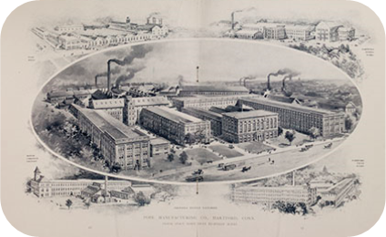
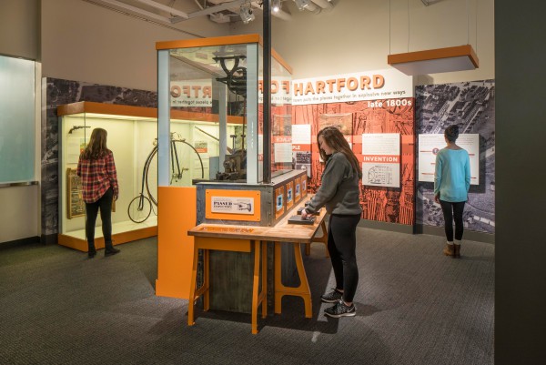 The exhibit notes that by the 1850’s “Hartford became the center of production for a wide array of products—including firearms by Colt, Richard Gatling and John Browning; Weed sewing machines; Royal and Underwood typewriters; Columbia bicycles; and even Pope automobiles.”
 rode his high-wheeler from the station down Capitol Avenue to the Weed Sewing Machine Company.’”
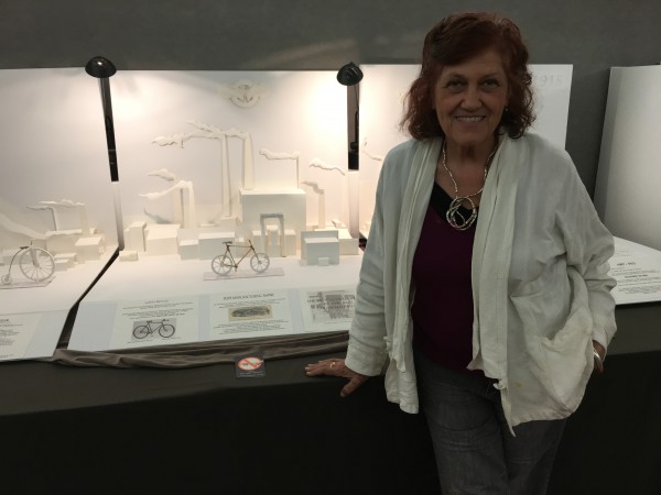 Jeanne Manzelli, a resident of Windsor, has a
 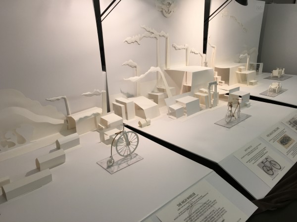 BFA in Sculpture from the Massachusetts College of Art and her MED in Art Education from the University of Massachusetts, Amherst. Her experience includes a 20 year career in design, manufacture, appraisal and sale of jewelry, two decades as mural artist working closely with interior designers as an industry professional, and 14 years teaching basic and advanced drawing, sculpture and 3D design as well as color theory at Tunxis Community College.


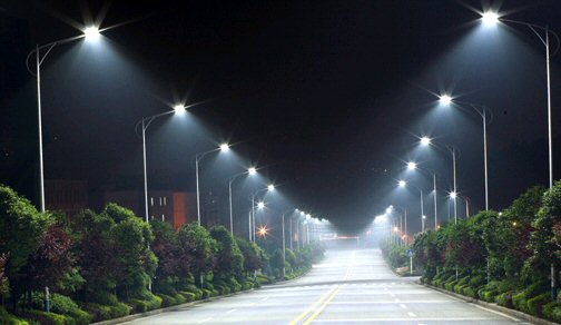
 In addition to its impact on drivers, the AMA notes that blue-rich LED streetlights operate at a wavelength that most adversely suppresses melatonin during night. It is estimated that white LED lamps have five times greater impact on circadian sleep rhythms than conventional street lamps, the AMA indicated. Recent large surveys, according to the AMA, found that brighter residential nighttime lighting is associated with reduced sleep times, dissatisfaction with sleep quality, excessive sleepiness, impaired daytime functioning and obesity.
 The Conversation website is a collaboration between editors and academics to provide "informed news analysis and commentary that’s free to read and republish." It
 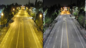 PHOTO: Traditional street lighting (left) vs. LED lighting (right).