
Weston, New Canaan Among Nation’s Richest Zip Codes
/
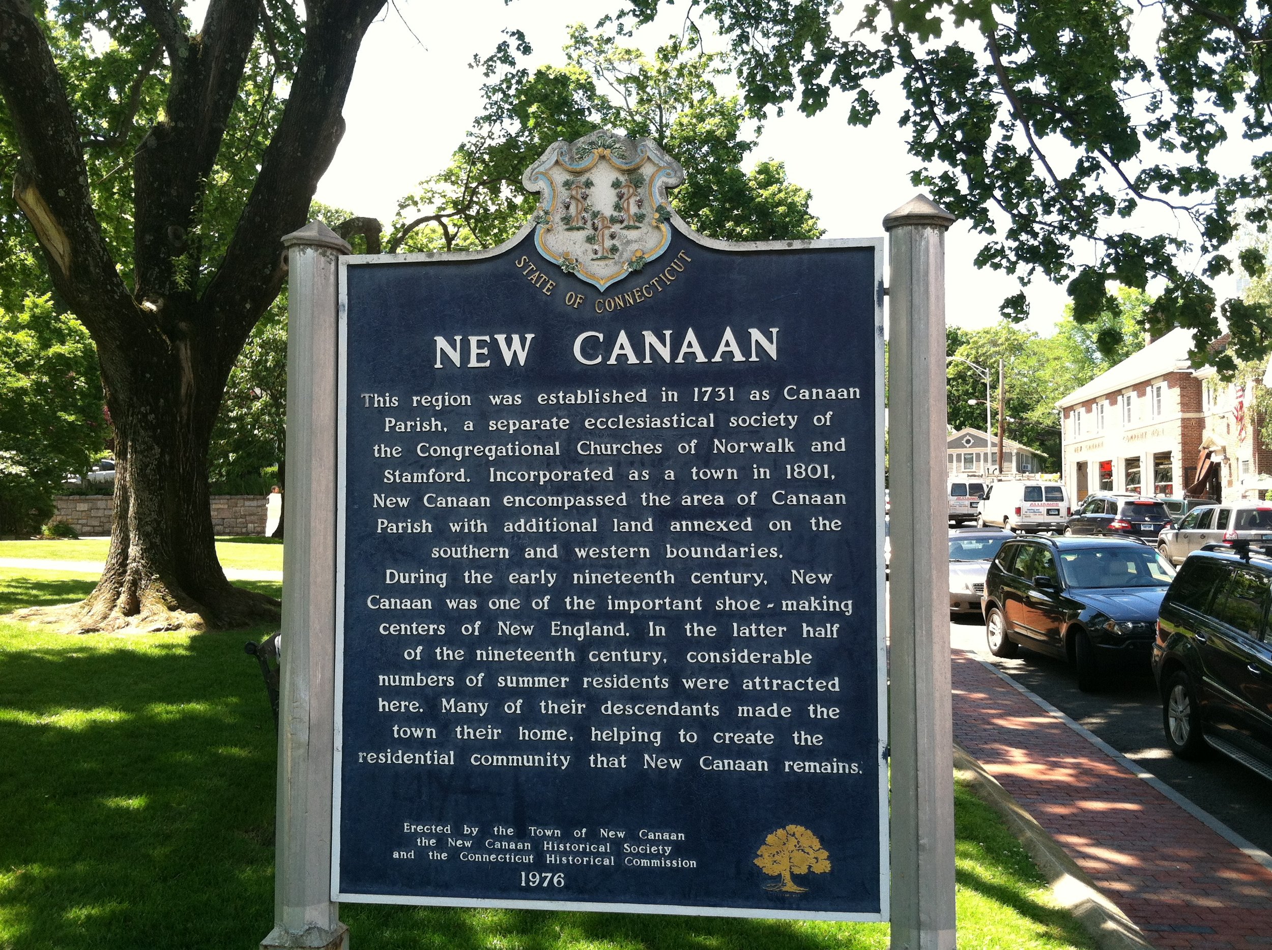
Weston and New Canaan are among the richest zip codes in the nation, according to an analysis by a University of Washington researcher. Based on data from the U.S. Census Bureau’s American Community Survey, the batting order of the nation’s richest zip codes includes the two Fairfield County communities – Weston at #10 and New Canaan at #11.
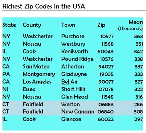 The zip code with the highest and the 4th highest incomes are in Westchester County, close to the Connecticut border. The second richest, Westbury, is in Nassau county, New York, which also has the 9th richest. Also in the New York City suburbs are the 8th, in New Jersey just 20 miles west of New York, while 10th and 11th richest are both located in Fairfield County, according to Richard Morrill, Professor Emeritus of Geography and Environmental Studies at the University of Washington, who outlined his research in newgeography.com.
The top 10 communities, by zip codes, are Purchase, N.Y.; Westbury, Long Island; Kenilworth, Illinois, Pound Ridge, N.Y., Atherton, California; Gladwyne, Pennsylvania; Bel Air, California; Short Hills, New Hersey, Glen Head, Long Island; followed by Weston and New Canaan.
“The most astounding thing about the map,” (which shows the “rich” zip codes by the county they are part of) Morrill points out, “is their concentration in a few areas, led by the country’s premier global city, greater New York city, with 75 of the 170.” New York is followed by Washington DC with 23, another sign of the growing wealth of the national capital. Boston follows with 10, Los Angeles, 18, San Francisco (14), and Chicago (6) and then a scattering in other leading metropolitan areas.
Morrill also looked at unequal income zip codes, where income disparity was most pronounced, and poor zip codes, which often included areas with a large student population, such as Storrs, which masked th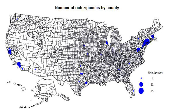 e income level of the overall population of the zip code. Among the poorest of the inner city poor areas, the data indicated, were in Los Angeles, Waterbury, CT; Portland, OR; and Youngstown and Canton, OH.
Morrill's research focuses on political geography (voting behavior, redistricting, local governance), population/demography/settlement/migration, urban geography, and planning, and urgan transportation. He concluded that “the zip code data provide a partial, highly localized look at the geography of inequality,” adding that “if American society continues to accept extreme income, the geography of inequality will only become not only more extreme, but more pronounced in a diverse set of locations.”